🥳 Välkommen till BegagnadKurslitteratur.se (🌟Nya begagnadeskolböcker.se)
Läs mer
| ISBN | 9781789959277 |
| Format | Häftad |
| Författare | Joel Lawhead |
| Publiceringsår | 2019-09-27 |
| Förlag | Packt Publishing Limited |
| Antal sidor | 456 |
| Språk | Engelska |
Häftad • 2019-09-27
Ej tillgänglig
Ej tillgänglig
Ej tillgänglig
Ej tillgänglig
Få ett meddelande när denna bok säljes begagnad igen.
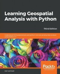
Boken Learning Geospatial Analysis with Python släpptes år 2019 och är skriven av Joel Lawhead.
Den består av 456 sidor och är skriven på engelska. Boken är utgiven av förlaget Packt Publishing Limited.
Vi kunde inte hitta något pris på vad den kostar ny.Learn the core concepts of geospatial data analysis for building actionable and insightful GIS applicationsKey FeaturesCreate GIS solutions using the new features introduced in Python 3.7Explore a range of GIS tools and libraries such as PostGIS, QGIS, and PROJLearn to automate geospatial analysis workflows using Python and JupyterBook DescriptionGeospatial analysis is used in almost every domain you can think of, including defense, farming, and even medicine. With this systematic guide, you'll get started with geographic information system (GIS) and remote sensing analysis using the latest features in Python.This book will take you through GIS techniques, geodatabases, geospatial raster data, and much more using the latest built-in tools and libraries in Python 3.7. You'll learn everything you need to know about using software packages or APIs and generic algorithms that can be used for different situations. Furthermore, you'll learn how to apply simple Python GIS geospatial processes to a variety of problems, and work with remote sensing data.By the end of the book, you'll be able to build a generic corporate system, which can be implemented in any organization to manage customer support requests and field support personnel.What you will learnAutomate geospatial analysis workflows using PythonCode the simplest possible GIS in just 60 lines of PythonCreate thematic maps with Python tools such as PyShp, OGR, and the Python Imaging LibraryUnderstand the different formats that geospatial data comes inProduce elevation contours using Python toolsCreate flood inundation modelsApply geospatial analysis to real-time data tracking and storm chasingWho this book is forThis book is for Python developers, researchers, or analysts who want to perform geospatial modeling and GIS analysis with Python. Basic knowledge of digital mapping and analysis using Python or other scripting languages will be helpful.
Nu när du vet att du vill köpa denna bok begagnad, och den finns tillgänglig så trycker du på den gröna knappen under annonserna för att komma i kontakt med säljarna.
Säljaren skickar en köpesförfrågan till dig som du enkelt accepterar. Säljaren får din adress för att skicka boken och du får instruktioner om hur du ska Swisha.
När du är färdig med din kurs så är nästa rimliga steg att du säljer boken till nästa års kull.
Det är helt gratis att sälja en bok på BegagnadKurslitteratur.se!